2.20.3 Iteration 2
2.20.3.1 Basic Parameter
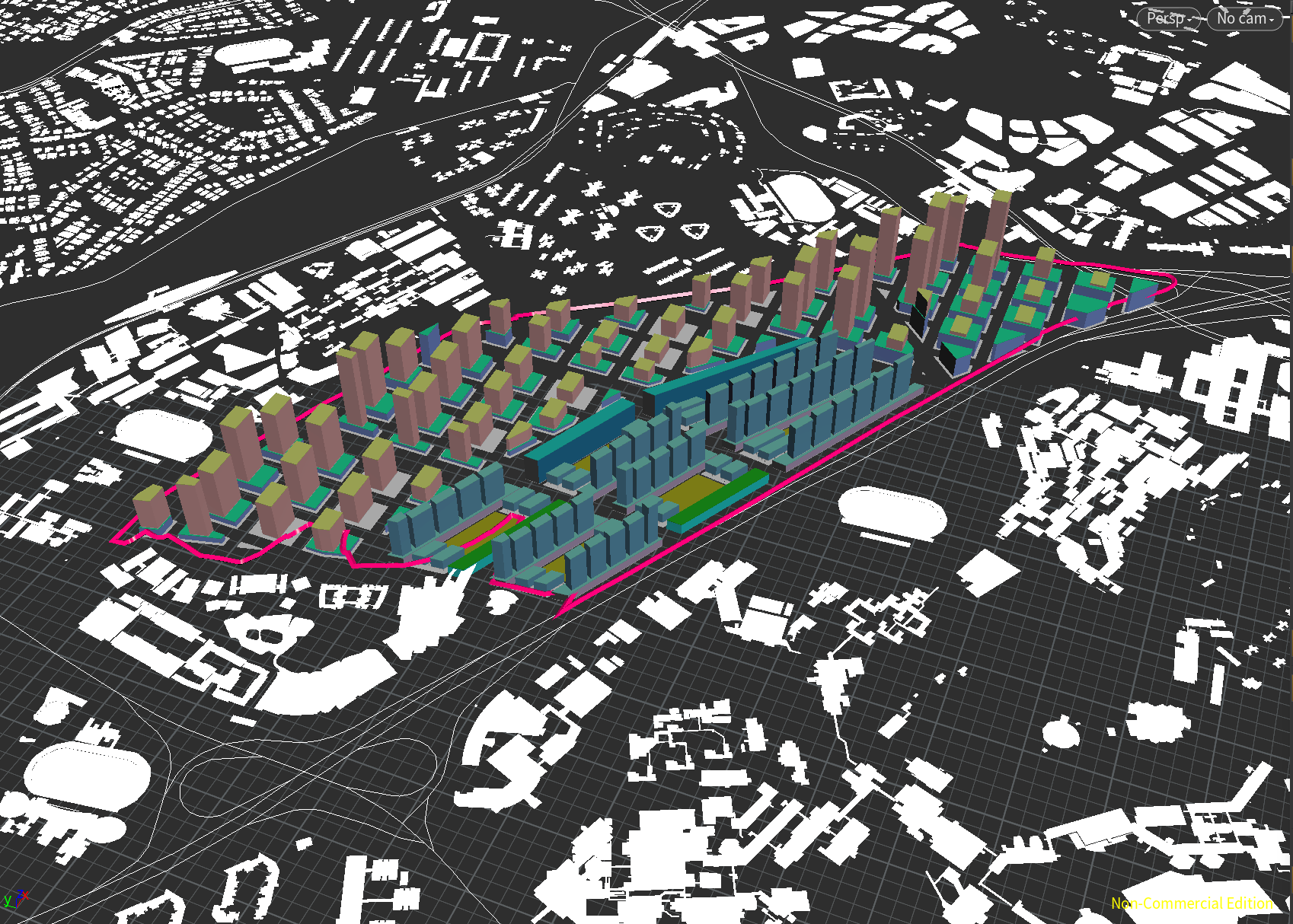
Street: 20m
Lanes:10m
Maximum floor count: 57
Average floor count: 7
Total number of buildings: 508
2.20.3.2 Simulation
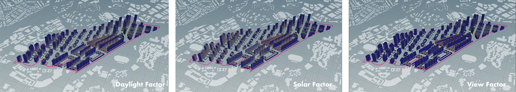
Good Window =58.1%
Daylight factor = 75.1%
Solar Factor = 84.9%
View Factor = 83.8%
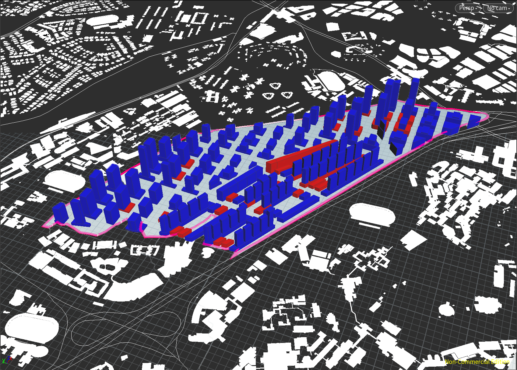
Good Building = 82.9%
Passive ratio = 100%
Good window ratio = 82.9%
2.20.3.3 Road Network
On the basis of Iteration1, in zone1, the width of the road network is increased, and the plot area is relatively reduced to 90m*60m. After the adjustment, evaluation parameters will be improved to a certain extent. The change of zone2 is to extend the middle road and divide the largest plots in the east, the internal courtyards from the previous five to six. After the change, the land utilization will be greatly improved, the only possible drawback is that the lighting of two rows of buildings along the middle road may be affected to some extent.
2.20.3.4 Building Form
Due to the change of the road network, Zone1 has reduced the plot area and adjusted the size of the podium and tower. By adjusting the parameters of polyexpand node, the floor area of the tower and podium was reduced, and the number of floors of the building was relatively increased. Therefore, compared with the Iteration1 building, the improved building was taller and leaner. In addition, the width of the tower is increased from north to south and decreased from east to west. This not only makes the northern and southern lighting surfaces larger, By adjusting the plot width in egg-slice of residential, the buildings of zone2 increase the width of the north and south facades and decreases the bad facades between two buildings, so that they have a larger good surface area and a better view. Low-rise residential buildings on both the east and west sides of the clusters are supported by columns in the groundfloor. Central courtyards on an axis are connected with each other, forming a green corridor on the line of sight.
2.20.3.5 Program Mix
Zone1 continues its previous function, in the form of a ground-floor commercial + residential tower. The functional layout of Zone2 has been changed. Firstly, the location of the industry is moved from the north side of the original plot to the south side, and the offices are moved to the side near the main road, so as to convenient to the residents from both sides to arrive. And the number of office buildings has been increased by reforming the road. Two rows of residents in the middle form a commercial inner street serving the community.
2.20.3.6 Evaluation
Compared with Iteration1, the evaluation results obtained were significantly improved, which was caused by widening the road network, thinning buildings, and the optimization of architectural form. However, there is still room for improvement. For example, several podium in Zone1 are still in red. The residential buildings on east and west sides of each cluster of Zone2, due to fewer floors, the evaluation results are not good. Specific, daylight factor, the higher floors illumination is sufficient, southwest solar is higher, since the buildings of Zone2 and Zone1 is not parallel, but has a certain Angle. Reflecting on the building, they have high solar value in different facades, but it's not that the higher the better, according to the standard, for good windows, solar threshold < 0.2. The view factor is generally good, especially the north-south facade, except for a few low buildings in the middle.